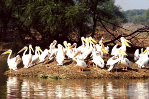
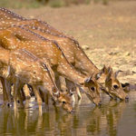
Often referred to as the eastern gate of Rajasthan, Bharatpur was carved out from Mewat and got its name from Lord Bharat (Lord Rama’s brother). The city is also home to one of the world’s best-known bird watching destinations, Keoladeo Ghana National Park (KNP), a man-made wetland is renowned for migratory birds – ducks, geese, waders, raptors, flycatchers and more.
History of Bharatpur
Bharatpur is part of ancient mythology with Bharatpur being place of Pandavas residence in the 13th year of their exile. During 5th Century BC, the area was part of Matsya Kingdom.
The place was ruled by an Indo-Scythian tribal community of Sinsinwar clan, who came to India in 100 AD.
At the end of the 17th century, Jat Baija with his son Rajaram, Zamindar of the village of Sinsini, took advantage of the weakness of the Mughal Empire to enlarge his territory.
In 1733 AD, Maharaja Suraj Mal built the city of Bharatpur. It is believed that it was a well-fortified city under his rule. Bharatpur was carved out from Mewat and got its name from Lord Bharat (Lord Rama’s brother). Lord Ram’s brother Laxman is the family deity of the erstwhile royal family of Bharatpur. The name ‘Laxman’ was engraved on the arms, seals and other emblems of the state.
Ranas of Gohad and the British signed a treaty and British helped the Jats to restore their rule from the Marathas in 1804 AD. In 1805, British signed a treaty with Marathas and the region came under the Maratha rule again.
Fairs & Festivals of Bharatpur
Brij Holi Festival
The Braj festival in Rajasthan is held every year for two days in the Shukla Paksha of the Phalgun month, a few days prior to Holi. The festival is dedicated to Lord Krishna who is believed to have spent a considerable amount of time in a region called Braj in Rajasthan. The highlight of this festival is the Raslila dance performed with great zest and unity.
Geography of Bharatpur
The terrain in Bharatpur & Nadbai is plain while that of Bayana & Rupbas tehsils is diversified by hills. Bharatpur is located in the arid terrains and is drained by seasonal rivers Ban Ganga, Rooparel, Kankud, Gambhir and Parvati. Bandh Baaretha Dam has been constructed on the Kakund River to supply water for drinking and irrigation purposes.
- The Ban Ganga river originates in Ramgarh hills in Jaipur and passes through Dausa and Bharatpur districts to meet the Yamuna River in Uttar Pradesh.
- The Rooparel River starts from Udaynath hills in Alwar District and enters the district in Kaman Tehsil.
- The Gambhir River starts from Pachana Dam of Karauli District, and meets the Ban Ganga in Bayana Tehsil.
Location, Area & Administration:
Bharatpur is referred to as eastern gate of Rajasthan and is situated between 26° 22′ to 27° 83′ North Latitude and 76° 53′ to 78° 17′ East Longitude, with an average elevation of 100 meters above sea level. The district touches district of Alwar in the North-West. The northern border of the district touches Gurgaon district (Haryana), eastern border touches district of Mathura(Uttar Pradesh), southern border touches district of Agra (Uttar Pradesh) and district of Dholpur of Rajasthan. It touches Dausa in south-west.
The district has an area of 5066 Sq. Km which is divided into 11 tehsils namely Bharatpur, Bhusawar, Bayana, Deeg, Kaman, Kumher, Nagar, Nadbai, Pahadi, Rupbas and Weir for administration.
Natural Places of Bharatpur
Keoladeo Ghana National Park
The Keoladeo Ghana National Park is considered to be one of the richest bird areas in the world today. It is a UNESCO world heritage site, Ramsar Wetland & included in Montreux Record. Every year, thousands of migratory waterfowl birds such as green sandpiper and cranes visit the park during winter.The wetlands of Bharatpur were formed when Jat ruler Suraj Mal, who ruled the area between 1726 and 1763, flooded a natural depression by building the Ajan Bund. Water was fed into the marshes twice a year from inundations of the Banganga (North) and Gambhir (South) rivers nearby. A well-designed system of canals, sluices and dykes currently maintains the level of water in different blocks of the park.
Over 370 species of birds either stop here while flying the Central Asian migratory flyway or remain as local residents. Migrants arrive from Afghanistan, Turkmenistan, China, Siberia and Mongolia. The bar-headed goose arrives here after flying over the Himalayas!
Bandh Baretha
Band Baretha is an old wildlife reserve of the rulers of Bharatpur, currently under the administration of the Forest Department. The construction of the dam on Kakund River was started by Maharaj Jaswant Singh in 1866 AD and completed by Maharaj Ram Singh in 1897 AD. The palace inside the reserve was built by Maharaj Kishan Singh and is the private property of the Bharatpur royal family. Band Baretha has been declared a wildlife sanctuary by state government and is a bird watcher’s paradise because of over 200 species of birds, including the elusive Black Bittern.
Bharatpur Natural Resources
Estimated 2.5% of the total area of the district comes under the area of mines and minerals. Minerals are generally found in the area of Bayana, Kama, Weir, Bhusawar, Deeg, Roopwas & Bharatpur. Main mineral found in the district are Saltpeter, Copper, Lead, Barytes, Silica Sand, Soap stone, Brick clay, quartzite etc. Brick clay is found generally all over the district.
Bharatpur Population
The district has population of 25,49,121. It has an average literacy rate of 82.13%, which is higher than the national average of 74.04%; with male literacy of 90.41% and female literacy of 72.80%. The languages commonly spoken in district are Hindi and Braj-Bhasha.
Map
How to Reach:
- By Air: The closest airport is Agra and is about 56 kms away.
- By Train: The city is on the Delhi-Mumbai broad gauge line. It is well-connected to Sawai Madhopur, Kota and Agra.
- By Road: A network of buses links the city with Agra as well as Jaipur.


