Often referred to as the ‘Venice of the East’ or the city of lakes, Udaipur is one of the most important cities of Rajasthan. Udaipur district is located in the southern part of the State, about 480 Kms South along NH-8 from Jaipur and about 250 Kms from Ahmedabad, Gujarat.
The city of Udaipur derives its name after Rana Udai Singh who founded it about 1559 A.D. Before, Udaipur district was carved in its present form; it was a part of the erstwhile princely State of Mewar. With the formation of the United Sates of Rajasthan in 1948, a Gogunda and Salumbar (Excluding Saira tehsil) were combined to constitute the Udaipur district.

History of Udaipur
The history of Udaipur is of considerable antiquity in form AHAR civilisation that flourished in the vicinity of Berach River. The chalco-lithic Ahar-Banas culture lasted from 3000 BCE to 1500 BCE. More than 90 sites of the culture have been identified till date, out of which, Gilund, Ahar, Ojiyana and Balathal are prominent sites.
The present city of Udaipur was founded in 1559 by Maharana Udai Singh II as a new capital of the Mewar kingdom. To protect Udaipur from External attacks, Maharana Udai Singh built a six kilometre long city wall, with seven gates, namely Surajpole, Chandpole, Udiapole, Hathipole, Ambapole, Brahmpole and so on. The area within these walls and gates is still known as the old city or the walled city.
As the Mughal empire weakened, the Sisodia rulers, reasserted their independence and recaptured most of Mewar except for Chittor. Udaipur remained the capital of the state, which became a princely state of British India in 1818.
After India’s independence, Mewar was included into the state of Rajasthan and Udaipur became a district.
Others Post related to History & Culture:

Geography of Udaipur
Udaipur district is situated in the southern part of Rajasthan, which is known as ‘Mewar’, between latitudes 23.49’ and 25.28’ N and longitudes 73.01’ and 75.49’ E at an average altitude of 579.4 m above sea level, covering an area of about 12,596 sq km, about 3.67% of the State of Rajasthan.
The city lies on the south slope of the Aravalli Range in Rajasthan. The Northern part of the district consists generally of elevated plateaus, while the eastern part has vast stretches of fertile plains. The southern part is covered with rocks, Hills and dense Forest. There are two important passages in the Aravali ranges viz. Desuri Nal and Saoke which serves as a link between Udaipur and Jodhpur District.
The Udaipur Lake System can be divided into the following categories:
- Upper lakes: Lake Badi, Chhota Madar & Bada Madar.
- City Lakes: Lake Pichola, Fateh Sagar Lake, Swaroop Sagar, Rang Sagar, Kumharia Talab, Goverdhan Sagar.
- Downstream Lake: Udaisagar Lake.
- River: Ahar River.
Administration of Udaipur Disctrict
District Collector and District Magistrate is the head of District Administration. There are two Additional Magistrate (ADM-Administration, ADM-City). The district has an area of 13,883 square kms which has been divided into 12 Sub-divisions & 13 Tehsils namely: Badgaon, Mavli, Gogunda, Kotda, Jhadol, Girwa, Vallabhnagar, Lasadiya, Salumber, Rishabhdeo, Kherwara, Sarada & Semari.
Udaipur district has 1 Lok Sabha constituency (elects member of Parliament) and 8 Vidhan Sabha (legislative assembly) constituencies. These are Udaipur, Gogunda, Jhadol, Kherwara, Mavli, Salumber, Udaipur Rural Vallabhnagar
Natural Resources of Udaipur:
The mining activity in the region is known since 14th century when the mining and smelting of lead and zinc was started in Zawar area.
The district is endowed with metallic as well as non metallic mineral wealth, the important are lead-zinc, copper, rock phosphate, soapstone, limestone, barytes, marble etc. In the field of gemstones, the district has shown potential for emerald. It is the leading producer of rock phosphate in the country. Among other minerals like lead-zinc, soapstone, green and pink marble, it has an important place. In the state, the district holds 1st position as far as the sale value of mineral production is concerned and is the 2nd mineral revenue earning district.
Population:
According to the 2011 census, the total urban population of the Udaipur district was 608,426. and the population density was 262/km2.
Recent News on Udaipur District
- Kumbhalgarh TR: Survey for Tiger Reserve Status in September 2021

- Birth, Death certificates to be digitised in Udaipur

- Project BOLD: Bamboo Oasis on Lands in Drought launched in Udaipur

- Udaipur bags fifth position in Smart City Ranking

- Indira Gandhi Matritva Poshan Yojana

- Swachh Survekshan 2020 Rankings & Awards

Location Map
Udaipur district is located at 24.58 degrees N. latitude and 73.68 degrees E. Longitude. The district is bordered by Rajsamand district in north, Chittorgarh & Pratapgarh district in the east, Banswara District in the southeast by, Dungarpur in south and Gujarat is south-east direction, Sirohi in West & Pali in North-west.
How to Reach
By Air
The nearest airport in the city is called the Maharana Pratap International Airport which is situated about 20 kilometres away from the city center. It is well-connected by air to all major cities in India including Delhi, Mumbai, Kolkata and Jaipur.
By Train
The city lies on a vast network of rail that connects it to major cities in India such as Jaipur, Delhi, Kolkata, Indore, Mumbai and Kota. In fact, the famous and luxurious Palace of Wheels also makes a scheduled stop in the city.
By Bus
There is a very well-established bus service network to the city, linking it to several cities like Delhi, Jaipur, Indore, Kota and Ahmedabad, among others. There are a number of options when it comes to travelling by bus. These include deluxe buses, air-conditioned coaches and State-run transport.
Road/Self Drive
The city is connected to Delhi and Mumbai by National Highway 8 (NH 8). The drive is about 10-11 hours long and covers a distance of roughly 700 kilometres from both the cities. Many tourists visiting the city prefer to drive on their own. If you do not wish to use your personal vehicle, there are several tour operators that provide vehicles on hire.
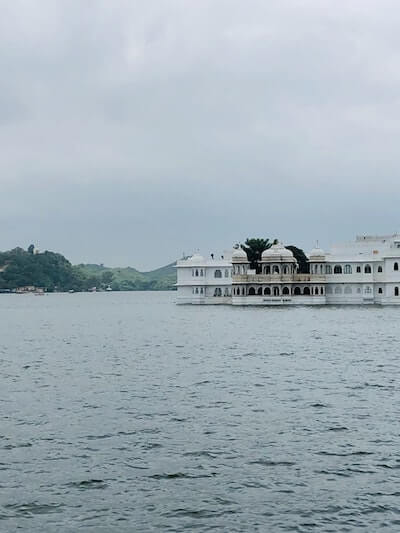
- Featured Image by Hardik Joshi | Photo of Lake Palace – Vikram Nath Chouhan


